top of page


How Can LiDAR Help You?

2D Ortho/Map. Real-time aerial view of property.

Colorized Point Cloud captured with LiDAR drone.

Elevation view of Point Cloud.

Classified Point Cloud. During this process, the ground points are separated from all other points.
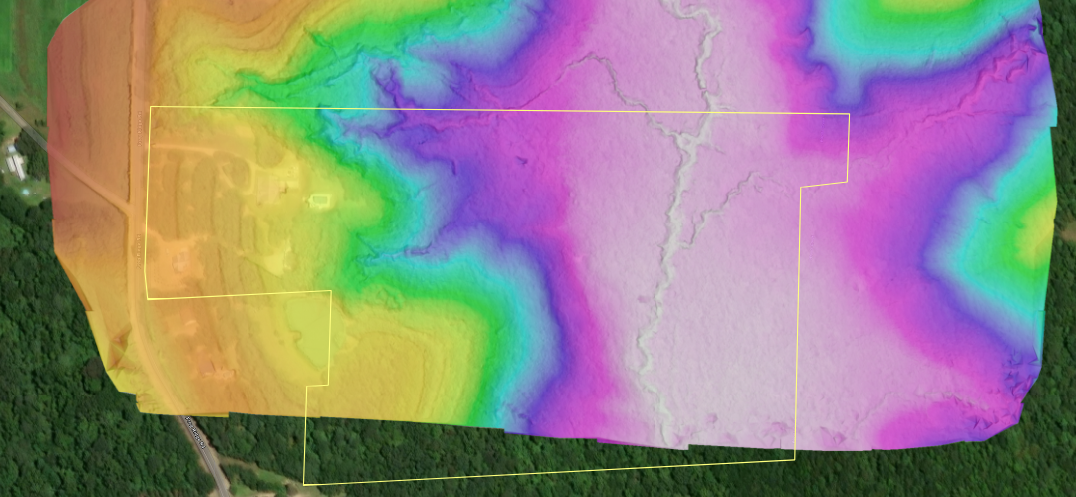
A DEM (Digital Elevation Model) is created from the ground points of the Point Cloud. This can be exported as a surface into CAD.

Contours are created from the DEM. This image shows the existing contours as well as proposed contours for this site design.

Cut/Fill maps can then be created to compare the existing surface (captured by the drone), to the proposed surface. We can then export a stakeout report for field operations.
bottom of page