
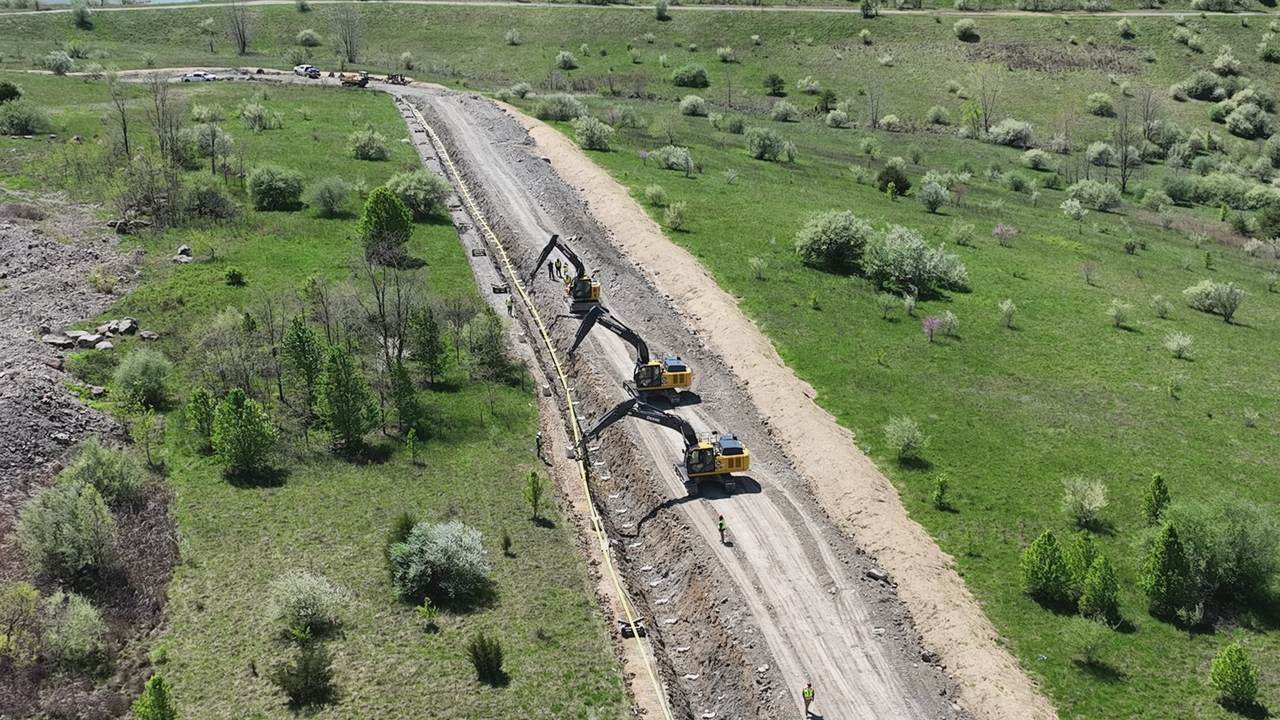
Repeatable, not random
The mission is saved after the first flight. Every visit after that flies the exact same lines, so month over month actually compares.
Quantities you can bill from
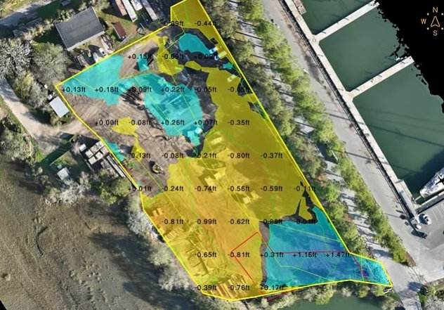
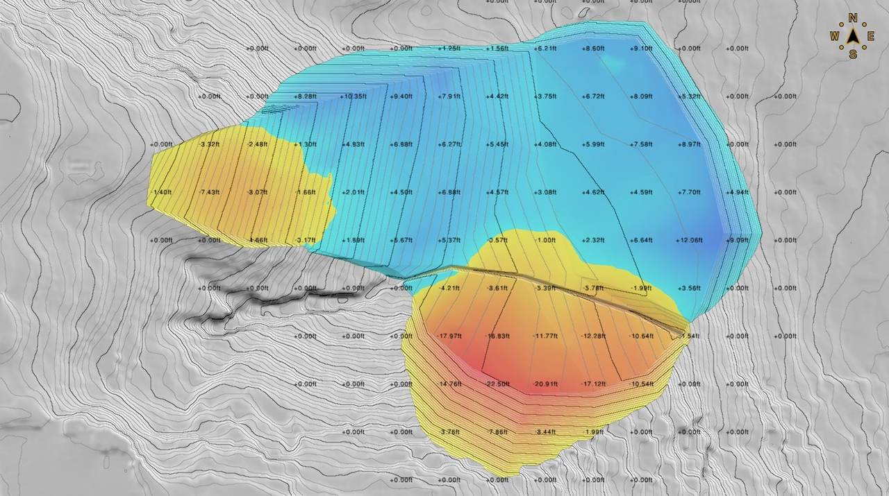
Cut, fill and stockpile volumes off an RTK-controlled flight — with the surfaces behind the numbers, not just a total.
Delivered in days, not weeks
Processing happens here. Nothing gets shipped to a third party and nothing sits in a queue behind someone else's job.
Progress over time
One site, four flights, same angle.
Same flight path and camera angle each visit, so month-over-month progress is apples to apples.
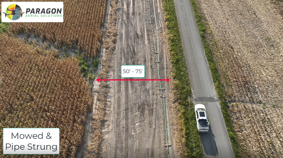
Month 1 — Cleared
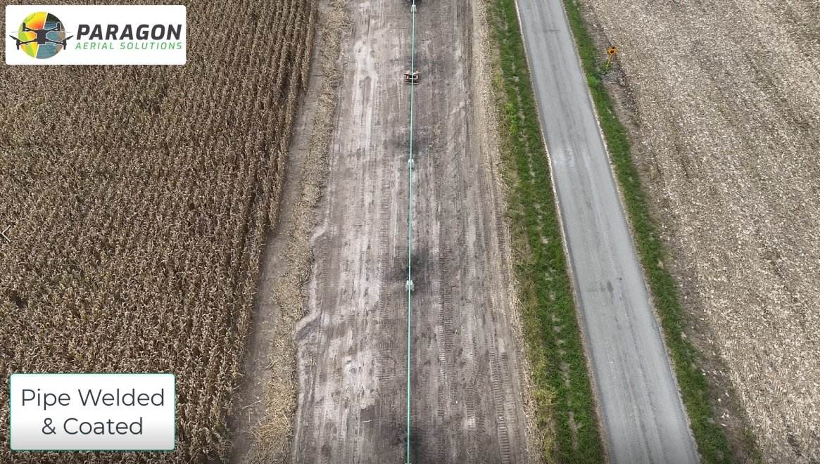
Month 3 — Pipe Strung
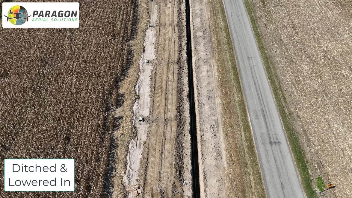
Month 5 — Ditched / Lowered In
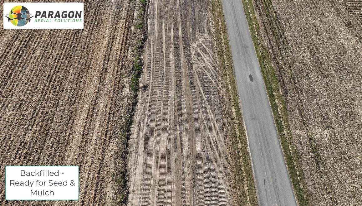
Month 8 — Ready for Restoration
Compare the Same Site at Different Dates
Video from Site Visit
Cut/Fill
What lands in your inbox
Dated orthomosaic of the full site
Stockpile and earthwork volumes
Fixed-point progress photos from set angles
360° panorama you can spin from the office
Short flyover video for owner and investor updates
Thermal passes on request — roofing, electrical, moisture
Pricing
Per Job
Provided upon request
*Minimum fee may apply
Site size and how much of it is active
Frequency — weekly, monthly, or milestone-based
Deliverable set — photos only, or full volumetrics
Travel and airspace authorization requirements